The Tundra
Tundra and Peaks.
This is page 2 of 3 pages. Links to other pages: Page 1 Page 2 Page 3
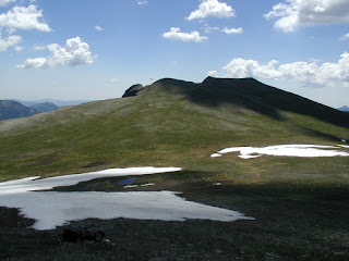
The Tundra Community Trailhead (also called the Toll Memorial Trail) features a signed, paved nature trail leading out over the tundra to a small peak. It is just above the tree line on the Trail Ridge Road.
Schist Over Granite.
The hard schist rock protected the softer granite below it. The unprotected granite eroded away leaving these outcrops. This is near the end of the Tundra Communities Trail.
More Schist Over Granite.
The trail is paved to protect the tundra. The large numbers of tourists would quickly trample all the tiny windflowers without a paved trail.
A few from the small peak at the end of the Tundra Communities Trail/ Toll Memorial Trail. This is looking back toward the parking area over the rise in the distance.
Me (Jess) at 12304 Feet Above Sea Level
UFO over Sundance Mountain. Yes, there is a U.F.O. in this photo, click on the picture to enlarge it. Can you see it? It is hovering over the left side of Sundance Mountain. What is it?
I think it's a flying insect and is just a few feet from my camera rather than over the mountain!
Mount Ida.
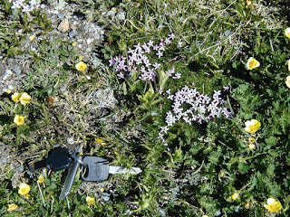
Tundra Wildflowers
Some examples of the tiny wild flowers found in the tundra. The keys to my rental car give an idea of size. Yes, I used a field guide to flowers to identify them. I'm not that good at plants!
Acomastylis rossii turbinata
Phlox sibirica pulvinata
Rydbergia grandiflora
Erigeron melanocephalus
Eritrichum aretioides
At the Summit
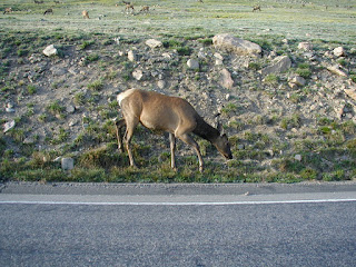
Many of the elk were laying in depressions, with only their antlers showing. The males were on one side of a small rise, the females were on the other side.
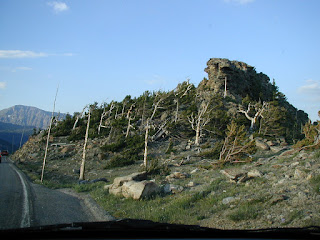
Wind blown trees Notice how the almost constant wind has distorted the shape of these trees.
Trees at tree line These tiny trees are found at the tree line. They aren't dwarf, they just don't have much time to grow each year. Some may be over 100 years old, and only a few feet tall!
The summit of the Trail Ridge Road, at 12,183 feet above sea level.


